Good Morning. This is Doug Chabot with the Gallatin National Forest Avalanche Advisory issued on Tuesday, January 23rd at 7:00 a.m. Today’s advisory is sponsored by the Gallatin Valley Snowmobile Assoc. and Yellowstone Club Community Foundation. This advisory does not apply to operating ski areas.
In the last 24 hours 8-10” of snow fell around Big Sky, 5” in Taylor Fork and near 10” around Lionhead. The Bridger Range, Hyalite and Cooke City received 2-4”. Under clearing skies temperatures are near 10F and winds are west at 15-20 mph, gusting to 40. Outside West Yellowstone and Cooke City winds are west at 10-20 mph. Today will be partly cloudy, temperatures will rise into the low 20s, and winds will be gusty out of the west. The southern ranges may get an inch of snow tonight.
Anywhere from 5-10” of low density snow fell around West Yellowstone. Winds are gusty and strong enough to form wind slabs. The snowpack in this area is weak and unstable. The new snow does not weigh much (.3” snow water equivalent), but it’s enough to discount any gains in strength that were made in the last couple days. Alex had collapsing and cracking on Saturday, the same day a motorized snow biker was killed 15 miles to the west, near Island Park, on Reas Peak (a synopsis is at the end of the advisory).
Avalanches may break 2-4’ deep on sugary facets. Alex explains the snowpack structure in his video. To sum up, cracking, collapsing, new snow and wind, avalanches and deaths, are evidence of dangerous conditions. If three avalanche fatalities in three weeks doesn’t get your attention, I’m not sure what will. Human triggered avalanches are likely today and the danger is rated CONSIDERABLE.
In the last 24 hours the mountains picked up low density, cold smoke powder (3-5%; .2-.4” of SWE), that will blow into 1-2’ thick drifts at the slightest breeze. On Saturday, in the Bridger Range, a skier was carried 800’ when he triggered a wind-loaded slope on the southeast face of Naya Nuki. On Sunday, a skier and his dog were caught (yes, the dog is ok) in a small 50’ wide wind-loaded zone on the Throne (photo). Other reports also involved wind-loaded slopes being triggered at Fairy Lake (photo) and Taylor Fork (photo), and a large natural slide on the east face of Mt. Abundance near Cooke City (photo) and other naturals on Barronette (photo). Today, new snow and wind are building wind slabs which will be sensitive to triggering.
Deeper in the snowpack is a layer of weak, sugary snow located 1-2’ off the ground. I found this layer in Taylor Fork on Sunday (video) when it broke in my stability test (ECTP 24). Conditions are variable and some slopes are stable while others are not, a common occurrence since the snowpack does not strengthen equally. This is why we do stability tests.
New snow and wind are creating a CONSIDERABLE avalanche danger on wind-loaded slopes. All other slopes have a MODERATE avalanche danger.
If you get out and have any avalanche or snowpack observations to share, drop a line via our website, email (mtavalanche@gmail.com), phone (406-587-6984), or Instagram (#gnfacobs).
AVALANCHE FATALITY REPORT: Reas Peak, Centennial Range, 20 January
On the afternoon of Saturday, January 20, four snow bikers (motorized) were riding southeast of Reas Peak (9,298’) in the Centennial Range in Idaho. The group was riding along a trail near a creek bed below 500-700’ high slopes that were greater than 35 degrees steepness. Two bikers rode up 15’ from the bottom of the slope when it released, catching and burying one. The group had rescue gear and located the victim quickly. The victim’s head was 6’ from the surface and CPR was initiated but unsuccessful. The avalanche was estimated to be 600’ wide, up to 2.5’ deep, and 2-300’ slope distance. It is classified SS-AMu-R2-D2-O. Photo of crown, burial location, Google Earth; news article.
A full report will be posted on Wednesday.
King and Queen of the Ridge
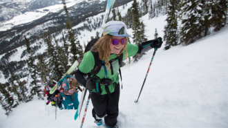
King and Queen of the Ridge, Saturday, February 3rd. A Hike and Ski/Ride-a-Thon fundraising event to support the Friends of the Gallatin National Forest Avalanche Center. Sign up and start collecting pledges HERE.
Upcoming Avalanche Education and Events
BOZEMAN
Jan. 24, 25 and 27, Advanced Avalanche Workshop w. Field Day, Info and Register Here
Feb. 6th, Sidecountry specific avalanche awareness for family and friends. 6-8 p.m. @ Beall Park
Feb. 7th, Woman’s specific avalanche awareness, 6-7:30 p.m. @ REI in Bozeman
Feb. 7th, Avalanche awareness, 6-7:00 p.m. @ Roskie Hall MSU
Feb. 9 and 10, Companion Rescue Clinic, Info and Register
March 2nd, Avalanche Awareness, 6-7:00 p.m. Bozeman Split Fest
March 7th, Avalanche Awareness, 6-7:30 p.m. @ REI
Dillion
Feb. 24th and 25th, Snowmobile intro to avalanches w/ field course. More info: https://msuextension.org/conference/.
WEST YELLOWSTONE
Feb. 3rd, Avalanche Awareness, 7-8 p.m. at West Yellowstone Holiday Inn Conference Center
Feb. 10th, Avalanche Awareness, 7-8 p.m. at West Yellowstone Holiday Inn Conference Center
COOKE CITY
Every Friday and Saturday, Current Conditions Update and Avalanche Rescue, Friday 6:30-7:30 p.m. at The Antler's Lodge in January. Saturday anytime between 10-2 @ Round Lake.
King and Queen of the Ridge, Saturday, February 3rd. A Hike and Ski/Ride-a-Thon fundraising event to support the Friends of the Gallatin National Forest Avalanche Center. Sign up and start collecting pledges HERE.